
By Henry Woolsey, Andy Finton, James DeNormandie, and Sarah Haggerty
Conserving the Biodiversity of Massachusetts in a Changing World

Graphic courtesy Massachusetts Division of Fisheries and Wildlife.
At the same time, native species and ecosystems across the Commonwealth face unprecedented threats. As the third most densely populated state in the nation, development continues to eliminate and fragment important habitats. Traffic volume has increased over time causing a rise in wildlife mortality, and invasive species continue to displace native plants and animals. Meanwhile, the emerging effects of climate change threaten complete disruption of the natural systems our native species depend on. In light of these threats, there is a critical need to protect the state’s biological diversity and ensure that ecosystems across Massachusetts remain viable.
BioMap2 provides a framework for protection and stewardship of those lands and waters that are most important for conserving the diversity of native plants and animals in Massachusetts. It was created to identify critically important species habitats and intact ecosystems across the state that, if protected, will enhance ecological resilience to climate change and other threats.

Photo by Chris Buelow.
Massachusetts’ Biodiversity Conservation Vision
A Comprehensive Approach
In 2001 the Massachusetts Natural Heritage and Endangered Species Program (NHESP)—a program within the Division of Fisheries and Wildlife—produced the first conservation plan for Massachusetts that actually laid out a map of the areas needed to protect the state’s breadth of terrestrial plant and animal habitats. That plan was called BioMap, and it identified “Core Habitats” as the highest priority for protection, and “Supporting Natural Landscape” areas as additional targets to help protect the integrity of the core habitats. In 2003, Natural Heritage produced a companion plan, Living Waters, which focused on freshwater species and ecosystems by mapping important aquatic habitats and watersheds.The BioMap and Living Waters plans and maps were widely accepted by the conservation community and were immediately used in land protection work across Massachusetts: public funding programs for land acquisition projects incorporated the BioMap into their ranking systems, towns incorporated it into their open space plans, and it was used to prioritize natural resource protection by state agencies, land trusts, and nonprofit organizations. Close to 72,000 acres identified as core habitat in 2001 were protected between the publication of BioMap and BioMap2, as well as 45,000 acres of supporting natural landscape. Combined, this represents nearly 70 percent of all lands protected by all entities between 2001 and 2010.

Photo by Bill Byrne.
Massachusetts’ original BioMap plan was based on data collected prior to 2001. By 2010, more than 4,000 new and updated rare species records had been added to the Natural Heritage and Endangered Species Program’s database. Over that decade, enhanced understanding of species requirements had also led to improved habitat mapping for state-listed species by NHESP. In addition, researchers at The Nature Conservancy and UMass Amherst had continued to develop spatial analyses to define resilient ecosystems, applying the latest understanding of how to best ensure that natural systems are able to respond to changing climate. There had also been significant changes in land use, development, and other threats to native biodiversity over the years. In 2009, the Massachusetts Audubon Society released the 4th edition of Losing Ground, which shows that, outside of developed areas, over half of the remainder of Massachusetts was now either in the Sprawl Frontier or Sprawl Danger Zone.
Additionally, in 2005, the Massachusetts Division of Fisheries and Wildlife completed its comprehensive State Wildlife Action Plan (SWAP) documenting the status of Massachusetts wildlife and providing recommendations to help guide wildlife conservation decision-making. The SWAP includes all the wildlife species listed under the Massachusetts Endangered Species Act (MESA), as well as more than 80 species that need conservation attention but do not meet the requirements for inclusion under the state Endangered Species Act. The SWAP document is organized around habitat types in need of conservation within the Commonwealth. While the original BioMap focused primarily on rare species protected under MESA, BioMap2 also addresses other species of conservation concern, their habitats, and the ecosystems that support them to create a map of most of the elements of SWAP.

Image courtesy Massachusetts Division of Fisheries and Wildlife.
For BioMap2, the Department of Fish and Game and the Division of Fisheries and Wildlife—primarily through the NHESP—worked closely with the Nature Conservancy to build on the success of the initial BioMap and Living Waters biodiversity conservation plans, and to implement the State Wildlife Action Plan. The result is an enhanced, updated, and more comprehensive BioMap using innovative GIS capabilities, improved biodiversity data, and increased biological expertise.
BioMap2: One Plan, Two Components
BioMap2 identifies two complementary spatial (geographic) “footprints”: core habitat and critical natural landscape. Core habitat identifies key areas that are critical for the long-term persistence of rare species and other species of conservation concern, as well as a wide diversity of natural communities and intact ecosystems across the Commonwealth. Protection of core habitats will help protect these specific species, natural communities, and habitats.
Critical natural landscape identifies large natural landscape blocks that are minimally impacted by development. If protected, these areas will provide habitat for wide-ranging native species, support intact ecological processes, maintain connectivity among habitats, and enhance ecological resilience to natural and manmade disturbances in a rapidly changing world. Areas delineated as critical natural landscape also include some of the lands adjacent to wetland, coastal, and aquatic core habitats to help ensure their continued health.
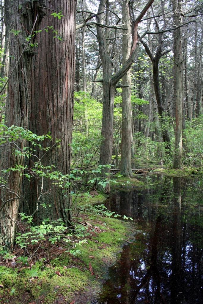
Photo by Chris Buelow.
The long-term persistence of Massachusetts’s biological resources requires a determined commitment to land and water conservation. Protection and stewardship of both critical natural landscapes and core habitats are needed to realize the biodiversity conservation vision of BioMap2.
Building a Better BioMap
The goal of the team behind BioMap2 was to build a readily accessible tool to guide land protection and stewardship for natural resource conservation in Massachusetts. To do this, the team first had to identify specific conservation objectives and determine which aspects of biodiversity should serve as conservation targets. Specific goals for rare and vulnerable species, natural communities, wetlands, rivers, forests, and landscapes were defined in order to prioritize areas critical for ensuring the long-term health of native species and ecosystems. This is essential for conserving the current biodiversity and for preparing for the largely unknown changes coming in the future from climate change and other threats.BioMap2 employs a combination of fine-filter and coarse-filter approaches. The fine-filter approach targets the conservation needs of individual species, especially those that are currently rare or uncommon, as well as those that may be threatened in the coming decades. The coarse-filter approach focuses on conservation of natural communities, intact ecosystems, and unbroken landscapes. Conservation of these systems will ensure that the vast majority of species are effectively protected, and that natural ecosystem functions, such as habitat connectivity and water purification, are maintained.

Image courtesy Massachusetts Division of Fisheries and Wildlife.
The selection and mapping of BioMap2 core habitats and critical natural landscapes involved identifying and mapping each conservation target, and ensuring they were well represented across the state. Each species, natural community, ecosystem, and landscape target was carefully mapped using innovative techniques to highlight those areas least impacted by development, and thus most likely to support biodiversity over time. The completed core habitats and critical natural landscapes were brought together under a single conservation plan: BioMap2.
Putting BioMap2 to Use
BioMap2 Components
Core Habitat
Core Habitat consists of 1,242,000 acres that are critical for the long-term persistence of rare species and other species of conservation concern, as well as a wide diversity of natural communities and intact ecosystems across the Commonwealth.

Photo by Bill Byrne.
Species of Conservation Concern include 475 species that are directly mapped in BioMap2. There are 413 species listed under the Massachusetts Endangered Species Act and an additional 62 non-listed species that were directly mapped in BioMap2. The directly mapped species totals are nine mammal, 50 bird, 15 reptile, seven amphibian, 27 fish, 111 invertebrate, and 256 plant species.
Priority Natural Communities include natural communities with limited distribution—regionally or globally—and the best examples documented of more common types such as old-growth tracts of widespread forest types. There are 782 examples of 94 different types of priority and exemplary natural community types included in BioMap2. Natural communities are defined as interacting assemblages of plant and animal species that share a common environment and occur together repeatedly on the landscape. Conservation of these areas will support the persistence of numerous characteristic common as well as rare species within Massachusetts.
Aquatic Cores identify core habitat for fish species of conservation concern and other aquatic species of conservation concern. In addition to various rivers and streams, a 30-meter band around each river segment is mapped, as well as wetlands that are wholly or partially contained within the band. The resulting aquatic cores are designed to protect ten MESA-listed fish, 17 non-listed fish, as well as 145 MESA-listed species with all or a portion of their life cycle in aquatic habitats.

Image courtesy Massachusetts Division of Fisheries and Wildlife.
Wetland Cores identify the most intact wetlands within less-developed landscapes—those generally with intact upland buffers, little fragmentation, and minimally disturbed by other stressors associated with roads and development. These wetlands, selected across a diversity of ecological settings, are most likely to support critical wetland functions (i.e., natural hydrologic conditions, diverse plant and animal habitats, etc.) and are most likely to maintain these functions into the future. All wetland priority natural communities are also included as part of wetland cores.
Vernal Pool Cores identify the top 5 percent most interconnected clusters of potential vernal pools. Each cluster of pools is buffered to create vernal pool habitat areas to target for conservation that includes the pools themselves and the surrounding habitat to allow for successful breeding, dispersal, overwintering, foraging, and migration. Targeting clusters of vernal pools, rather than only individual pools, will maximize the resistance and resilience of vernal pool habitats and their resident species in the context of climate change.
Forest Cores identifiy the best examples of large, intact forests that are least impacted by roads and development, providing critical “forest interior” habitat for numerous woodland species. Forest core minimum sizes range from about 500 acres in eastern Massachusetts and major river valleys, to over 2,000 acres in the western Massachusetts highlands.
Critical Natural Landscape
Critical Natural Landscape consists of 1,783,000 acres complementing and in many cases overlapping core habitat, including large natural landscape blocks and buffering uplands around coastal, wetland and aquatic core habitats to help ensure their long-term integrity.

Image courtesy Massachusetts Division of Fisheries and Wildlife.
Landscape Blocks provide habitat for wide-ranging native species, support intact ecological processes, maintain connectivity among habitats, and enhance ecological resilience. They are large areas of intact and predominately natural vegetation, consisting of contiguous forests, wetlands, rivers, lakes, and ponds, as well as coastal habitats such as barrier beaches and salt marshes. Pastures and power line rights-of-way, which are less intensively altered than most developed areas, are also included since they provide habitat and connectivity for many species. Different size thresholds were used to select the largest landscape blocks in certain ecoregions.
Foraging Habitat for Tern Species identifies the offshore habitat used by MESA-listed roseate, Arctic, common, and least terns when foraging for food.
Upland Buffers of Wetland Cores identify upland areas adjacent to all wetland cores. If protected, these upland areas will help support the functioning of each wetland over the long term.
Upland Buffers of Aquatic Cores identify upland areas adjacent to all aquatic cores. If protected, these upland areas will help protect river, stream, lake, and pond habitat over the long-term.
Upland Habitat to Support Coastal Adaptation identify upland areas adjacent to salt marshes where these habitats might move to as sea levels rise. Undeveloped lands adjacent to and up to one and a half meters above existing salt marsh elevations are identified, and included as part of critical natural landscape given their high potential to support inland migration of salt marsh and other coastal habitats over the coming century.

Image courtesy Massachusetts Division of Fisheries and Wildlife.
Ecoregions
Ecoregions are geographic areas with similar topography, geology, and predominant vegetation, and therefore represent areas of relatively homogeneous ecological setting. The ecoregions of Massachusetts were used to select ecosystems across a diversity of ecological settings, and are (from west to east): Taconic Mountains, Western New England Marble Valleys, Berkshire Plateau, Connecticut River Valley, Worcester Plateau, Boston Basin and Southern New England Coastal, Bristol and Narragansett Lowlands, and Cape Cod and Islands.
Land Protection
Land protection is a crucial tool to protect the biodiversity values defined by BioMap2; however, it will not be possible to protect the entire BioMap2 area in the near term. Thoughtful local, regional, and statewide land-use planning will complement direct land protection in safeguarding these areas and supporting human communities that rely on our state’s natural resources. In addition to differences in scale, core habitat and critical natural landscape differ in the amount of human impact each can tolerate and still retain their important habitat values. Simple land protection may be the best conservation strategy within most areas of core habitat, but extensive landscape blocks (found in the critical natural landscape) will support moderate levels of compatible human use such as timber harvesting in working forests and specific agricultural practices. This allows more flexibility in the types of land protection tools available for preserving biodiversity within critical natural landscape. Reptiles—such as the endangered copperhead shown above (photo by Bill Byrne)—are one of the most vulnerable taxonomic groups in Massachusetts. Of 29 native reptile species, 19 (67 percent) are recognized as species of conservation concern. Eleven turtle species (73 percent) and four snake species (29 percent) are state listed and seven of the turtle species are federally listed.
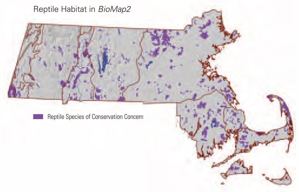 Preserving viable populations of both rare and common reptiles is a daunting challenge as a result of their population and life history characteristics and the degree of development pressure in much of Massachusetts. Many reptiles move annually among a variety of wetland and terrestrial habitats, often over distances of thousands of feet. For this reason, reptiles are highly susceptible to road mortality and other adverse effects of habitat fragmentation. Local populations of some species, such as the Eastern box turtle, occur at low densities. These species require relatively large areas of unfragmented wetland and terrestrial habitats in order to preserve viable populations.
BioMap2 includes 408,000 acres of core habitat for rare or uncommon reptiles, 57 percent of which remain unprotected.
Conservation groups—including local land trusts, statewide nonprofits, government agencies, and municipalities—have their own goals and criteria for conservation. Prioritization for protection among core habitat areas and critical natural landscapes will depend on the overall goals and objectives of each conservation organization. For example, an organization intent on protecting vernal pool habitat could target areas within core habitat delineated for that specific habitat type. An organization intent on maintaining landscape level processes, such as a watershed conservation association or town-based conservation group, may target critical natural landscape. BioMap2 is a flexible tool to allow individual conservation entities to further their specific conservation goals.
BioMap2 can contribute to improved conservation planning, increased coordination among conservation groups and government officials, and more effective biodiversity conservation. Often, by necessity, land conservationists find themselves reacting to immediate crises, whether the imminent construction of 50 houses in a favorite forest or a family needing to sell its woodlands to settle an estate. Using BioMap2 to develop and target protection priorities proactively, before a crisis emerges, can facilitate more efficient use of limited conservation dollars.
In addition to biodiversity protection, there are many other reasons to protect land from development, such as protecting drinking water supplies, providing recreational opportunities, and preserving aesthetic and cultural landscapes. Coupling biodiversity protection efforts with these concerns strengthens public support for land conservation overall and develops broader and more effective constituencies. Incorporating BioMap2 core habitats and critical natural landscapes into municipal open space and recreation plans, for example, can help communities to discover overlapping reasons to focus on particular areas.
Stewardship and Restoration of Biodiversity
Although the economic pressure to develop natural land in parts of Massachusetts has slowed recently, land protection continues to remain an important focus for many conservation organizations, agencies, and municipalities. However, management of land and water, and ecological restoration of habitats are also critical components of biodiversity conservation. Some species require active management by humans for their habitats to persist, either because the natural ecological processes that support biodiversity have been disrupted or because humans have encroached upon and altered the habitats of native species.
Photo by Bill Byrne.
In the past, dynamic ecosystems and important natural disturbances, such as flooding, storms, or wildfires, created conditions many different species were dependent on. With the current density of human development in the state, formerly dynamic systems are now constrained by roads, commercial and residential development, and other infrastructure, rendering the landscape more static and biodiversity less resilient. But by restoring ecological processes, habitat management can often restore the specific conditions required by different species or natural communities.
Other challenges to biodiversity, including the introduction of invasive species, habitat fragmentation from roads and dams, and alterations to stream flow, also require active management. Innovative strategies—such as invasive species control, dam removal, culvert replacement and improvement, and removal of tidal flow restrictions—are necessary to abate these problems.
BioMap2: Into the Future
BioMap2 builds on the original statewide conservation plans and the State Wildlife Action Plan to prioritize and guide biodiversity conservation in Massachusetts in the context of continued development and the anticipated effects of climate change. It is based on the latest survey information and spatial analyses available, and it identifies the areas of highest conservation value for a wide variety of plants, animals, and natural systems. Working together, with BioMap2 as a roadmap, we can protect the natural heritage of Massachusetts for years to come.
- BioMap2 identifies 2.1 million acres that are key to the protection of the state’s biodiversity
- Identifies 1,242,000 acres of Core Habitat (24% of state), 559,000 acres protected
- Identifies 1,783,000 acres of Critical Natural Landscape (34% of state), 778,000 acres protected
- Approximately 42% of the land included in BioMap2 has been permanently protected (core habitat and critical natural landscape may overlap), over 861,000 acres
- A joint project of the Massachusetts Department of Fish and Game (with funding from the Natural Heritage and Endangered Species Fund, Open Space Institute, and Doris Duke Charitable Foundation) and The Nature Conservancy (with funding from The Ackerman Conservation Fund, Toward Sustainability Foundation, and Elinor M. and Joel L. Siner)
Core Habitat includes:
- Species of conservation concern
- Priority natural communities
- Vernal pool cores
- Forest cores
- Aquatic cores
- Wetland cores
Critical Natural Landscape includes:
- Landscape blocks
- Foraging habitat for tern species
- Upland buffers to wetland cores
- Upland buffers to aquatic cores
- Upland buffers to support coastal adaptation
Andy Finton is director of conservation science for The Nature Conservancy in Massachusetts, working with Conservancy staff and partners across the Northeast to safeguard the region’s lands, waters, and coastal systems. Andy was the NHESP’s project manager for the original BioMap. Andy holds a B.S. in plant sciences from Cornell University and an M.S. in forest ecology from the University of Massachusetts.
James DeNormandie is a conservation planner and is the GIS director at the Boston office of LandVest. He was project coordinator of BioMap2. He also produced the 4th edition of Losing Ground, which examined the impacts of recent and historical land use change in Massachusetts. James holds a B.A. from Harvard University in biology and environmental science and a M.S. in wildlife ecology from Utah State University.
Sarah Haggerty is the information manager for the Massachusetts Natural Heritage and Endangered Species Program. She assisted in editing the BioMap2 products and was project manager for the development and publication of the BioMap2 Town Reports. Sarah holds a B.A. in biology from Bowdoin College and a M.S. in wildlife and fisheries conservation from UMASS Amherst.
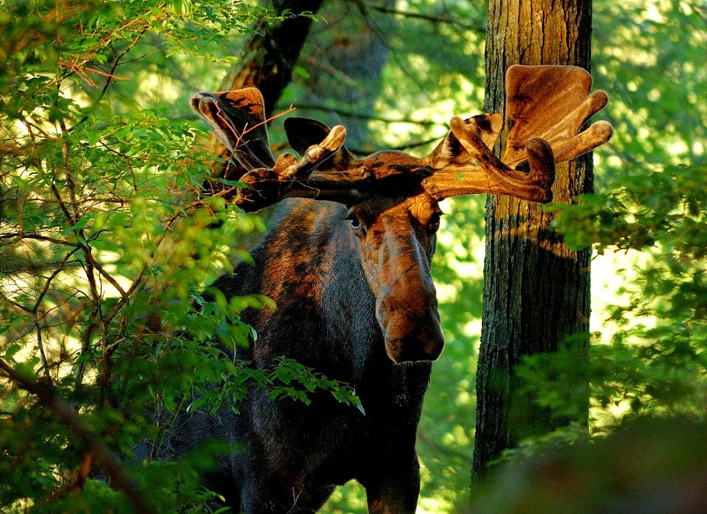
Header photo and home page photo of moose by Bill Byrne.